top of page


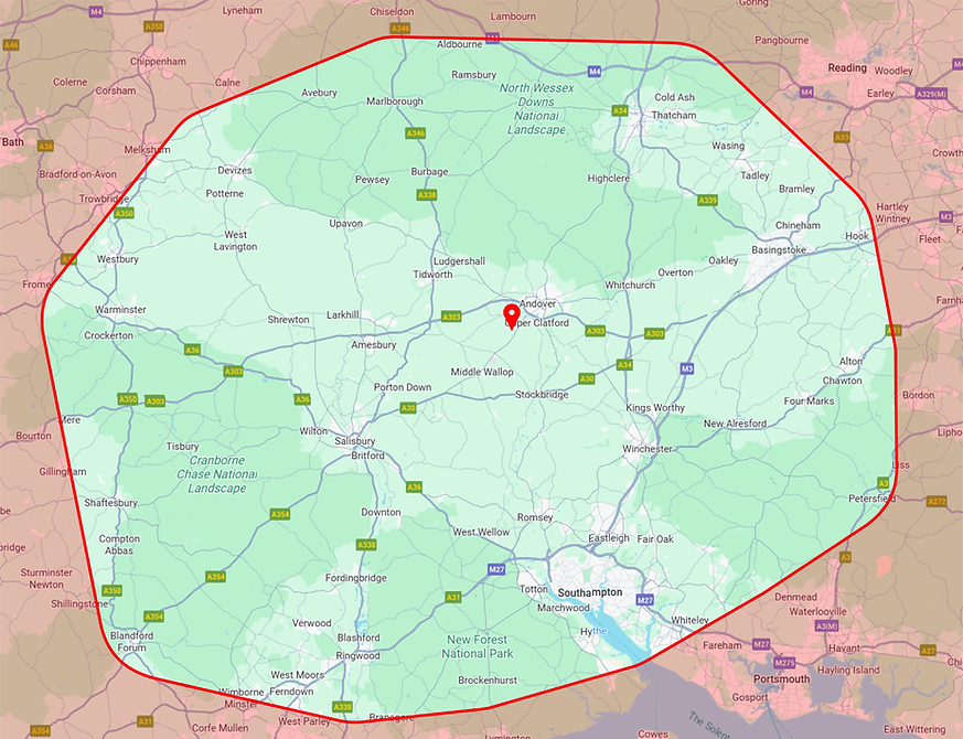
Areas Covered

The green area represents the area we cover. Outside this area, please call us.
As you may be aware, drone operations are governed by strict regulations, which responsible operators must follow at all times. As part of our standard operating procedures, we submit pre-flight notifications to the relevant Air Traffic Control authority, advising them of the location and timing of each flight.
Certain areas are subject to airspace restrictions or Flight Restriction Zones, where drone operations require specific approval from local Air Traffic Control. Once the intended flight location is confirmed, we will manage all necessary permissions, documentation, and coordination with air traffic services on your behalf.

This site is protected by International Copyright
bottom of page